views
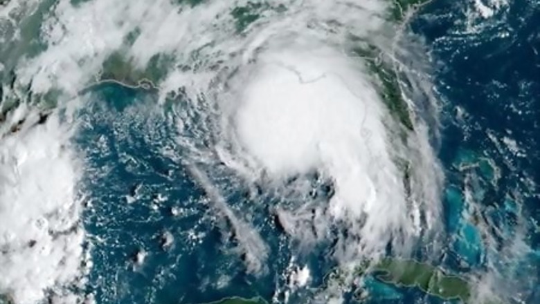
HOUSTON: Louisiana and Mississippi residents were under evacuation orders on Monday as Hurricane Sally churned across the Gulf of Mexico, strengthening to a hurricane ahead of expected landfall on Tuesday, the U.S. National Hurricane Center said.
The second storm in less than a month to threaten the region, Sally was headed toward a slow-motion landfall on the U.S. Gulf Coast. Residents from Louisiana to Florida were told to expect heavy rain, storm surge and high winds.
Sally is the 18th named storm in the Atlantic this year and will be the eighth of tropical storm or hurricane strength to hit the United States – something “very rare if not a record,” said Dan Kottlowski, senior meteorologist at AccuWeather.
Mississippi and Louisiana issued mandatory evacuation orders to residents of low-lying areas. Louisiana Governor John Bel Edwards appealed for a federal disaster declaration and advised people living in Sally’s path to flee.
“We have to make sure that everything is tied down and out of the way so it doesn’t float away or become airborne,” said Steve Forstall, a Bay St. Louis, Mississippi, port employee.
In the coastal town, located roughly 50 miles (80 km) northeast of New Orleans, water from the bay was spilling onto the beach roadway early on Monday. Workers were seen boarding up homes and securing items like trash cans that can become projectiles in high winds. Residents helped each other fill sandbags at a do-it-yourself station, and some people parked cars and boats on higher ground, anticipating flooded roads.
The U.S. Coast Guard was limiting traffic from the Port of New Orleans, while energy companies slowed or cut refinery output and scrambled to pull workers from offshore oil and gas production platforms.
At 1 p.m. CDT (1800 GMT), Sally was 125 miles (210 km) east-southeast of the mouth of the Mississippi River, packing sustained winds of 90 miles (145 km) per hour, according to the NHC.
The storm will approach southeastern Louisiana on Monday night but not make landfall until sometime on Tuesday, the NHC said. Its slow movement is expected to dump 8 to 16 inches (20 to 40 cm) on the coast and cause widespread river flooding.
A expected turn to the north is “going to be critical for the New Orleans area,” said Jim Foerster, chief meteorologist at DTN, an energy, agriculture and weather data provider. Mississippi appears more likely for landfall, but Sally’s biggest threat is that it will be a “rainmaker” across a wide swath of the Gulf Coast and drop much as 3 to 4 inches (7.62 to 10.2 cm) in areas as far inland as Atlanta, Foerster said.
Residents of southwestern Louisiana are still clearing debris and tens of thousands of homes are without power after Hurricane Laura left a trail of destruction. Sally’s path remains east of that hard-hit area.
Damage from Sally is expected to reach $2 billion to $3 billion, but could exceed that if the storm’s heaviest rainfall happens over land instead of in the Gulf, said Chuck Watson of Enki Research, which models and tracks tropical storms.
Disclaimer: This post has been auto-published from an agency feed without any modifications to the text and has not been reviewed by an editor


Comments
0 comment