
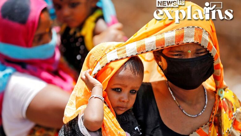
A warning regarding the anticipated heatwave from March to May has been released by the Union Health Ministry. The “Dos and Don’ts” list was released as the Indian Meteorological Service issued its first heat advisory for 2023.
The National Disaster Management Authority estimates that by 2020, there would have been 23 states affected by such waves, more than quadruple the number in 2015. Last March was the warmest India had seen in more than a century, with severe heat waves destroying harvests and resulting in widespread power outages. READ MORE on this here
As per a report by the Hindu, the IMD had issued a warning the week of February 21 that maximum temperatures across northwest, west, and central India would be 3-5° C higher than the long-term normal. The national capital saw its third hottest February day (33.6° C) in more than five decades on February 21.
And as per Kalinga TV, the temperature in some regions of the Odisha may reach 40 to 42 degrees in the first week of March. The report said temperature would rise by 3 to 5 degrees in most coastal and western portions of the state, and that the daytime temperature in North and South Odisha districts is predicted to rise by 2 to 4 degrees.
Is a Heatwave Coming?
The early temperature rise is due to weak western disturbances and, as a result, less rainfall. Skymet Weather Services president GP Sharma told CNBC-TV18 that that temperatures are mostly under control “over the northern or central part…by the western disturbance, which we know starts early in November and lasts through December, January, and February. As they march on, they begin to shift northward.”
Throughout November and December, however, there were no substantial western disturbances. “There is a lack of rainfall in plains and hilly regions when they are generally quiet. The deficit continues to grow, and it will be reflected in the temperature profile in areas of Haryana, Delhi, Rajasthan, and even Madhya Pradesh.”
GP Sharma went on to highlight the effect of current La Nina conditions in rising temperatures. “We are experiencing La Nia for the third year in a row (which has a negative impact on the Indian monsoon)…this scenario results in lower than average rainfall…you can expect increased heat… This worries me since it will continue till March,” he told CNBC-TV18. Trade winds are greater than usual during La Nia occurrences, driving more warm water towards Asia.
What is a Western Disturbance?
A western disturbance is an extratropical storm that forms in the Mediterranean region and brings heavy winter rain to the northern Indian subcontinent, extending as far east as northern Bangladesh and south-eastern Nepal.
The westerlies are driving a non-monsoonal precipitation pattern. The moisture in these storms typically originates over the Mediterranean, Caspian, and Black Seas. Extratropical storms are a global phenomenon that carry moisture in the upper atmosphere, as opposed to tropical storms, which carry moisture in the lower atmosphere.
When a storm system encounters the Himalayas, moisture is sometimes shed as rain on the Indian subcontinent. During the winter, western disturbances become more frequent and stronger.
According to a National Geographic, La Nina is a climate pattern that describes the cooling of surface-ocean waters along South America’s tropical west coast. La Nina is thought to be the polar opposite of El Nino, which is characterised by unusually warm ocean temperatures in the Pacific Ocean’s equatorial region.
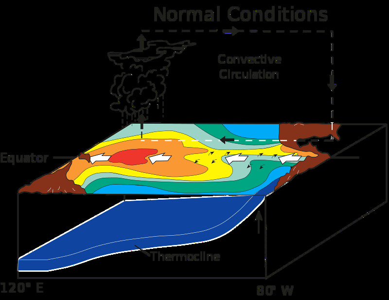

La Nina and El Nio are the “cold” (La Nina) and “warm” (El Nino) phases of the El Nino-Southern Oscillation, respectively (ENSO). ENSO is a grouping of weather and ocean-related phenomena and is distinguished by changes in atmospheric pressure as well as unusually warm or cool sea-surface temperatures.
La Nina events occasionally occur after El Nino events, which occur at irregular intervals of about two to seven years. The local effects of La Nina (“little girl” in Spanish) on weather are generally the inverse of those associated with El Nino (“little boy” in Spanish). As a result, La Nina is also known as anti-El Nino and El Viejo (the old man in Spanish).
What Causes Heatwaves?
As per a report by Hindu, a study published in Nature Geoscience on February 20, 2023, provides insight into how many factors contribute to the production of a heat wave. The report adjusts the study’s findings to the Indian context.
In the spring, air usually comes in from the west-northwest. This is bad news for India for a number of reasons, the report says. In terms of climate change, the Middle East is warming faster than other regions with similar latitudes to the equator, and it acts as a source of warm air that blows towards India.
Similarly, as air from the northwest rushes in over the mountains of Afghanistan and Pakistan, some compression occurs on the leeward side of these mountains, bringing prickly warmth into India, it says.
Because land warms faster than the oceans, air coming in over the oceans is predicted to deliver cooler air (because the heat capacity of land is much lower). Unfortunately, the Arabian Sea is warming faster than the majority of other ocean basins.
The near-surface winds are then controlled by the powerful high atmospheric westerly winds that blow in from the Atlantic Ocean over to India in the spring. When winds blow from west to east, keep in mind that they are moving faster than the globe, which is also spinning from west to east. The energy required to run near the earth’s surface against surface friction can only come from above. This descending air compresses and warms up, causing heat waves to form.
Finally, as a result of global warming, the so-called lapse rate – the pace at which temperatures decrease from the surface to the higher atmosphere – is decreasing. To put it another way, global warming warms the upper atmosphere faster than the air near the surface. As a result of global warming, the sinking air is warmer and causes heat waves as it sinks and compresses.
Given the processes that lead to the production of a heat wave and how global warming affects them, it should be evident why once-a-decade heat wave events have begun to occur once every few years and are also more powerful. The area covered by these heat waves is also influenced by background pressure patterns created by El Nio and La Nia occurrences, and it has recently been expanding.
This story was originally published on February 27, 2023.
Read all the Latest Explainers here


Comments
0 comment