
The cyclone over Arabian Sea, named ‘Biparjoy’, has swiftly strengthened into a highly intense cyclonic storm. Meteorologists anticipate a relatively gentle onset of the monsoon in Kerala, accompanied by a feeble progression beyond the southern peninsula, influenced by this cyclone. The India Meteorological Department (IMD) stated on Wednesday morning that the conditions are favorable for the monsoon to arrive in Kerala within the next two days.
Meteorologists, however, said the cyclone has been impacting the intensity of the monsoon and the onset over Kerala would be “mild”. The MeT office said the very severe cyclonic storm would intensify further and move northwards during the next three days. However, the IMD has not yet predicted any major impact on countries adjoining the Arabian Sea, including India, Oman, Iran and Pakistan.
Let’s Look At Some of The Updates
Cyclone Biparjoy Latest Position
According the latest IMD update, ‘Very Severe Cyclonic Storm’ Biparjoy laid centered about 850 km west-southwest of Goa, 900 km southwest of Mumbai, 930 km south-southwest of Porbandar and 1220 km south of Karachi.
IMD said it is likely intensify further over the next three days.
VSCS BIPARJOY over eastcentral Arabian Sea, lay centered at 0830 IST of today, near lat 14.0N & long 66.0E, about 850 km west-southwest of Goa, 900 km southwest of Mumbai, 930 km south-southwest of Porbandar and 1220 km south of Karachi. To intensify further during next 3 days. pic.twitter.com/aXZb3vQTnP— India Meteorological Department (@Indiametdept) June 8, 2023
“Severe Cyclonic Storm Biparjoy VSCS BIPARJOY over eastcentral Arabian Sea, lay centered at 0830 IST of today, near lat 14.0N & long 66.0E, about 850 km west-southwest of Goa, 900 km southwest of Mumbai, 930 km south-southwest of Porbandar and 1220 km south of Karachi. To intensify further during next 3 days,” the IMD tweet read.
RAIN FORECAST
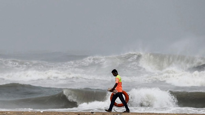
Cyclone Biparjoy impact is expected scattered rains all over Maharashtra and intense rainfall in Mumbai and Pune likely from June 8 to 10.
Meanwhile, according to IMD’s June 7 bulletin light to moderate fairly widespread rainfall with thunderstorm/lightning/gusty winds are very likely over Kerala, Lakshadweep, Coastal and South Interior Karnataka over the next five days.
Isolated to scattered activity over North Interior Karnataka, Tamil Nadu and Andhra Pradesh is also predicted during next five days.
Heavy rainfall is likely at isolated places over Andaman & Nicobar Islands from June 7 to 9, in Kerala from June 7 to 11, in Lakshadweep from June 9 to 11; and On June 10 and 11 in Karnataka.
SEA CONDITIONS FROM TODAY
As per IMD, Sea condition is likely to be very high to “phenomenal” over central Arabian Sea and adjoining south Arabian Sea and it is likely to become “phenomenal” from evening of June 8 over the same region. Sea condition is likely to be rough over Arabian Sea along & off Karnataka-Goa-Maharashtra coasts.
June 9: Sea condition is likely to be “phenomenal” over central Arabian Sea. Sea condition is likely to be rough over adjoining areas of Arabian Sea and along and off Karnataka-Goa-Maharashtra coasts.
June 10: Sea condition is likely to be “phenomenal” over central Arabian Sea. Sea condition is likely to be rough over adjoining areas of north Arabian Sea and along and off Karnataka-Goa-Maharashtra coasts.
June 11: Sea condition is likely to be “phenomenal” to very high over central and adjoining north Arabian Sea. Sea condition is likely to be rough to very rough over adjoining areas of northeast Arabian Sea and along and off Maharashtra-Gujarat coasts.
June 12: Sea condition is likely to be “phenomenal” to very high over central and adjoining north Arabian Sea. Sea condition is likely to be rough over adjoining areas of northeast Arabian Sea and along and off Maharashtra-Gujarat coasts.
Cyclone Biparjoy: Latest Position
As per IMD’s latest tweet, Very Severe Cyclonic Storm Biparjoy,
over eastcentral Arabian Sea, laid centered at 5:30 am today about 860 km west-southwest of Goa, 910 km southwest of Mumbai.
Cyclone Biparjoy would intensify further and move north-northwestwards, IDM said.
VSCS BIPARJOY over eastcentral Arabian Sea, lay centered at 0530hrs IST of 08thJune, near lat 13.9N & long 66.0E, about 860km west-southwest of Goa, 910km southwest of Mumbai, would intensify further & move north-northwestwards. pic.twitter.com/6HiSydw2qI— India Meteorological Department (@Indiametdept) June 8, 2023
Gujarat Govt Says ‘Fully Prepared’ to Deal With Natural Calamities
With Cyclone Biparjoy impact likely to bring light rain in Gujarat, the state government on Wednesday said it was fully prepared to deal with possible natural calamities.
According to IMD, Biparjoy, the first storm brewing in the Arabian Sea this year, is likely to cause wind gusts of 40 to 50 kmph in coastal districts in the coming days and also bring light rains in parts of the state.
Fishermen in Gujarat have been warned not to venture into the Arabian sea till June 14. The cyclone is likely to cause light rains in Saurashtra and south Gujarat regions between June 9 and 11, an IMD official said.
Weather Warnings
IMD has that predicted coastal areas of Lakshadweep, Karnataka, Goa, and Maharashtra are likely to face impact of Cyclone Biparjoy. The weather department has issued a wind warning for these regions for the next five days.
Wind speeds today are expected to go up to 115-125 kmph, and further to 140 kmph from the evening. Areas along the Karnataka, Goa, and Maharashtra coasts are likely to experience strong winds.
By tomorrow, wind speeds may escalate to 135-145 kmph, gusting up to 160 kmph from the evening, impacting the adjoining areas of the South Arabian Sea, Karnataka, and the Goa-Maharashtra coasts.
On June 10, which is day after tomorrow, winds with speeds of 145-155 kmph, going up to 170 kmph, are expected over the central Arabian Sea. The adjoining areas of the south Arabian Sea, along with the coasts of north Karnataka, Goa, and Maharashtra, may also be impacted.
Landfall
Cyclone Biparjoy is expected to make landfall in Pakistan. As per IMD’s last update, the very severe cyclonic storm laid centered at 11:30 pm on June 7 about 870km west-southwest of Goa, 930 km southwest of Mumbai.
“It would intensify further gradually during next 48 hours and move nearly north-northwestwards during next three days,” IMD said.
Biparjoy To Head Northwards
Meteorologists say the tentative track of the system will be in the northward direction but storms at times defy the predicted track and the intensity. Forecasting agencies said the storm has been undergoing “rapid intensification”, escalating from just a cyclonic circulation to a very severe cyclonic storm in just 48 hours, defying earlier predictions. Atmospheric conditions and cloud mass indicate that the system is likely to sustain the strength of a very severe cyclone till June 12.
Scientists say cyclonic storms in the Bay of Bengal and the Arabian Sea have been intensifying rapidly and retaining their intensity for a longer duration due to climate change. According to a study ‘Changing status of tropical cyclones over the north Indian Ocean’, the frequency, duration, and intensity of cyclones in the Arabian Sea have increased by about 20 per cent in the post-monsoon period and 40 per cent in the pre-monsoon period. There has been a 52 per cent increase in the number of cyclones in the Arabian Sea, while very severe cyclones have increased by 150 per cent.
Increase in Cyclonic Activity Due to Rising Ocean Temp
“The increase in cyclone activity in the Arabian Sea is tightly linked to the rising ocean temperatures and increased availability of moisture under global warming. The Arabian Sea used to be cool, but now it is a warm pool,” Roxy Mathew Koll, climate scientist at the Indian Institute of Tropical Meteorology, said. “The oceans have become warmer already on account of climate change. In fact, a recent study shows that the Arabian Sea has warmed up by almost 1.2 degrees Celsius since March, thus conditions are very much favourable for the rapid intensification of the system (Cyclone Bipajoy) so it has potential to sustain the strength for a longer period,” Raghu Murtugudde, Professor, Department of Atmospheric and Oceanic Science, University of Maryland and IIT Bombay, said. Mahesh Palawat, vice president (climate and meteorology) Skymet Weather, said the cloud mass is concentrated around this system and enough moisture is not reaching the Kerala coast. Though the criteria for monsoon onset can be met in the next two days, it will not be a thumping start. After the onset over Kerala, the monsoon will remain “weak” until the storm degenerates around June 12, he said.
Monsoon Onset Over Kerala Has Varied
Skymet had predicted the monsoon onset over Kerala on June 7 with an error margin of three days. Over the last 150 years, the date of monsoon onset over Kerala has varied widely, the earliest being May 11, 1918 and the most delayed being June 18, 1972, according to IMD data.
The southwest monsoon arrived in the southern state on May 29 last year, June 3 in 2021, June 1 in 2020, June 8 in 2019 and May 29 in 2018. Research shows a delay in the monsoon onset over Kerala (MOK) does not necessarily mean a delay in the monsoon onset over northwest India.
Normal To Below Normal Rainfall for North
Northwest India is expected to see normal to below-normal rainfall. East and northeast, central, and south peninsula are expected to receive normal rainfall at 94-106 per cent of the long-period average of 87 cm. Rainfall less than 90 per cent of the long-period average is considered ‘deficient’, between 90 per cent and 95 per cent is ‘below normal’, between 105 per cent and 110 per cent is ‘above normal’ and more than 100 per cent is ‘excess’ precipitation.
Normal rainfall is critical for India’s agricultural landscape, with 52 per cent of the net cultivated area relying on it. It is also crucial for replenishing of reservoirs critical for drinking water apart from power generation across the country. Rainfed agriculture accounts for about 40 per cent of the country’s total food production, making it a crucial contributor to India’s food security and economic stability.
(With PTI inputs)


Comments
0 comment