
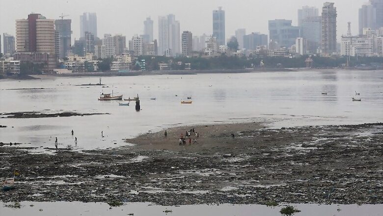
Cyclonic storm ‘Nisarga’ that formed over the Arabian Sea on Tuesday is likely to make a landfall close to Alibag in Raigad district as a severe cyclonic storm, sparing Mumbai of its full fury.
However, with its proximity to Alibag, the western part of the storm’s expanse will cross over the country’s financial capital, Director General of India Meteorological Department (IMD), Mrutyunjay Mohapatra, told News18.
This will trigger heavy rainfall in Mumbai, its suburban areas and the districts of Thane and Palghar that lie to the north of Mumbai.
Besides, Valsad, Navsari, Dang, Daman, Dadra and Nagar Haveli and Surat districts will see light to moderate rainfall from June 3 onwards.
“The cyclone will impact Mumbai as it is not too far from Alibag. Winds in the range of 100-110 kmph will be seen in Mumbai and neighbouring areas and gusting up to 120 kmph is possible. The cloud bands in the western sector of the cyclone will pass over Mumbai and its suburban areas,” Mohapatra said.
Senior IMD scientists said multiple models that were run to estimate the track of the cyclone showed highest chances of landfall near Alibag.
“There are low chances that the track of the cyclone will move north of Mumbai towards Thane or Palghar. Most models are showing that the cyclone track will be south of Mumbai city near Alibag,” said KS Hosalikar, Deputy Director General, IMD (Mumbai).
Earlier, models of international meteorological agencies were showing different tracks however. After the weather system intensified into a deep depression, most models showed that the landfall would occur in the coastal town of Alibag.
The strong winds and heavy rains are not the only worry for Mumbai, already battered by the Coronavirus pandemic.
The city and neighbouring Thane are also likely to see storm surges of 1-2m height above the astronomical tides, which may flood the city’s low-lying areas 1-1.5km inland.
The problem will be compounded if the landfall and subsequent storm surge happens during a high tide.
Mumbai often faces woes of water-logging and especially so if there is incessant rainfall during a high tide. This prevents rain water from draining into the sea quickly.
“It is not just the cyclone and winds that are a problem. If strong winds, heavy rainfall coincide with the high tide, it may lead to flooding and clogging. This can become a classic case of compound events which we have discussed at length in the Intergovernmental Panel on Climate Change (IPC) special report on Oceans and Cryosphere in a Changing Climate,” said Roxy Mathew Koll, climate scientist at Indian Institute of Tropical Meteorology and one of the lead authors of the IPCC report.
The IPCC report that came out in 2019 talked about compound events as a combination of multiple drivers and/or hazards that contribute to societal or environmental risks.
Rare Cyclone in Pre-monsoon Period
Koll also said the cyclone is perhaps the first one to affect Maharashtra’s coast in the month of June since 1891.
Vineet Kumar Singh, a PhD student working with Koll, compiled a data of cyclonic storms since record-keeping began and found that it is the first-ever June cyclone since 1891 and the only other pre-monsoon cyclone to hit Maharashtra was the one in May 1961.
“We already see a detectable increase in post-monsoon tropical cyclones over the Arabian Sea. Are we moving towards such a trend during the pre-monsoon also? During the recent years, we have seen a surge in Arabian Sea cyclones occurring close to the monsoon onset, but we are yet to understand if there is a climate change element to it. Regardless, the IPCC reports indicate an increase in Arabian Sea cyclones during the pre- and post-monsoon seasons as a response to the rapid ocean warming trends,” Koll added.


Comments
0 comment