views
NEW ORLEANS: A nearly $2 billion plan to divert water and sediment from the Mississippi River to rebuild land in southeastern Louisiana considered the cornerstone of the state’s efforts to protect its rapidly eroding coast has passed a major milestone with the publication of the long-awaited Army Corps of Engineers environmental impact study.
The report issued late Thursday spells out the potential benefits of the plan projected to build thousands of acres of freshwater marshes on the western side of the Mississippi River that will help knock down storm surge in the New Orleans area to the north. But it will also have damaging effects on the state’s important shrimping and oyster industries as well as dolphins and some coastal communities.
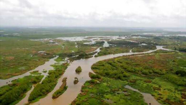
The Mid-Barataria Sediment Diversion will essentially cut a hole into the levee around the town of Ironton, southeast of New Orleans, and channel part of the river’s flow into Barataria Bay. As the water moves into the bay, sediment settles and eventually accumulates into land. It’s considered the most important project of the state’s $50 billion coastal protection plan that details various measures the state is taking to protect a coast that has lost 2,000 square miles (5,200 square kilometers) since 1932.
This project is a lifeline for coastal Louisiana. … It is the shot in the arm that our coast needs right now, said Chip Kline, who chairs the agency charged with protecting the state’s coast.
The concept has been discussed for decades and essentially tries to recreate nature. Southeastern Louisiana is formed of sediment that washed down the Mississippi River and deposited over thousands of years. But as the river was leveed to protect surrounding communities, the sediment instead washed into the Gulf of Mexico.
The loss of sediment coupled with canals dug for oil and gas development and navigation allowed saltwater to push farther and farther into areas like Barataria Bay.
To build the diversion, the state must get permission from the Army Corps of Engineers which issues a draft environmental impact statement spelling out the potential impacts of the project and the state suggests how it will mitigate those.
The money to build the diversion comes from fines BP paid after the 2009 Deepwater Horizon oil spill that sent millions of gallons into the Gulf of Mexico and killed 11 rig workers. Barataria Bay was ground zero for the oil damage.
The group that oversees how the oil spill fines are spent has released a report detailing the diversion’s benefits and impacts and why they support going ahead with it.
At top capacity, the project would divert 75,000 cubic feet (2,125 cubic meters) of water per second from the Mississippi River through a 2-mile-long (3-kilometer-long) concrete channel into the bay. Gates at the river’s edge would control the flow and the state would have an extensive monitoring system to measure things like salinity levels in the bay.
A final permit could be issued as early as next year after public comments.
According to the report, the diversion could build as much as 17,300 acres (27 square miles) by 2050, although the acreage would drop in later years because of sea level rise and subsidence. The resulting land and marsh would help to knock down storm surge by as much as 1 foot (.3 meters) in the New Orleans area.
The strongest opposition to the diversion has come from members of the states fishing industry, particularly shrimpers and oyster growers that are an integral part of the states culture, history and economy. They worry about the effects of adding so much freshwater to an area thats largely saltwater right now.
The Corps study said the change in salinity levels in the bay would have major, adverse impacts on eastern oysters and brown shrimp.
The state is proposing to help oyster harvesters and shrimp fishermen adapt to the changes with measures such as paying for refrigeration units for shrimping boats that have to travel farther to shrimp or paying to establish more oyster seed grounds in different areas.
Brad Robin’s family opened Robin’s Seafood in 1947 but have been fishing in the coastal waters even longer than that. His business now focuses exclusively on oysters, and he’s a member of the state’s oyster task force. He’s worried that the diversion will devastate the oyster harvesting on the western side of the river the way that the extended opening of the Bonnet Carre Spillway in 2019 devastated oysters on the eastern side of the river.
The question I ask all the time,” he said. “Just tell us the truth: Where do we fit in?
The report also said the diversion could reduce the number of dolphins that live in the bay by a third over two decades. The state is proposing various mitigation efforts such as expanding its network to monitor for stranded dolphins and putting money toward reducing other stresses.
The diversion will also increase tidal flooding in many of the small fishing communities farther south along the river, including some minority and low-income communities. State mitigation efforts include raising roads, houses and infrastructure or in some cases buying out properties.
Disclaimer: This post has been auto-published from an agency feed without any modifications to the text and has not been reviewed by an editor
Read all the Latest News, Breaking News and Coronavirus News here


Comments
0 comment