

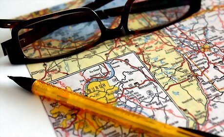
Realize that maps are not more difficult to understand that reading a recipe for dinner, once you learn what the assorted markings and labels mean. Look around the edges of the map (or in the case of an atlas, in the first few pages) to find a "legend" that will help to decode what the different colors mean.
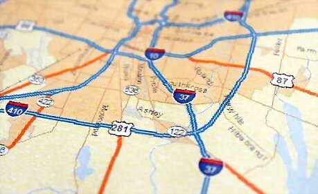
A little knowledge about the way highways are numbered can go a long way. In the US, an odd numbered highway (85, 67, etc) runs north and south, up and down on the map, as north is ordinarily always at the top of the page. Even numbered highways (40, 66, etc) always run east to west, from side to side on the map.
Know that, generally, the bolder the line, the bigger the road. Interstates lay on the map like arteries, which small roads look like veins, smaller roads probably will not even be marked on large maps. (Which is good; if you think a map is complicated as it is, imagine adding billions of other lines to denote every road!)
Rely on major intersections (such as when an interstate crosses a major highway, or when two interstates cross, any prominent intersection) as a reference point. When you Arrive at an intersection, try to locate a place to park and reference to the map. You can easily find yourself by just looking for the intersection that involves the two roads that intersect near you.
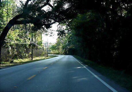
Often, if you can remember the curves a road has given, even if it isn't clearly marked what the name or number of the road is, you can identify it if you know the general region. If the road you are on is going east to west (west being your example direction of travel), and had a long straight section and then a sweeping left-hand turn, look on the map for roads going left to right, with a long straight section and a bend going downward. Continuing down this road, and relating the curves to the bends of the road on the map can give you a pinpoint location. If you go through a section of long S-curves after the long straight and sweeping left, and the road on the map goes right to left, bends downward, and then weaves back and forth like a snake, you can be assumed that this is the road you are on, and can find your way from there to wherever you want to go.
Know that roads that circle a city are usually called "bypasses" because they allow non-city traffic to bypass the headaches of driving straight through. If a road bends around a city on the map, and there is only one road of major prominence that does so and you see a sign denoting a bypass, there is a good likelihood that the bend around the city is the bypass you are approaching.
Study maps. It can be a fun hobby to study maps and learn about the roads, and for some reason, people may forget the recipe to mushroom soup, but can retain the major highways of Oklahoma. Make it a personal point of pride to know something about the lay of the roads in your home area, so that even if you never become lost, you can assist someone who may be lost. Knowing you are heading south on highway 20 is helpful, but knowing that just outside of Such and Such City it connects with 36 which loops back to your hometown is a comfort!


Comments
0 comment